Aerial Photography vs New Topographics
航空写真 / ニュー・トポグラフィックス
Aerial Photography comes from Photographic Genres and New Topographics from Photography Movements. Both are read here as style. They are reached for with some of the same intent, which is where they get confused.
Aerial Photography

.jpg)

The view from above begun with Nadar's balloon: the vertical gaze that turns cities into figures, passing through survey and war into landscape-as-abstraction, and on to satellites and drones.
New Topographics

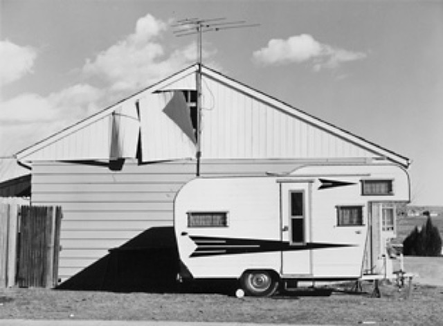
Turns from grand natural scenery to the landscapes people have altered, recording suburbs, graded building sites and industrial zones without heat.
| Aerial Photography | New Topographics | |
|---|---|---|
| Era | 1858– | 1975– |
| Family | Photographic Genres | Photography Movements |
| Kind | Style | Style |
| Cues | The vertical view as figure / Terrain drawn by shadow / The gridded city / Scale without people | Empty suburbs / Frontality / Dry color / Man-altered landscape |
| Best used for | Showing the full extent of a city plan or a disaster in one frame · Graphics that use the shape of the land itself as figure | Recording how a city edge or a graded site changes, year after year, under identical conditions. · Reports and exhibitions that present development as it is, without staging. |
| Type | Always carry scale, north and date, set small in a corner | Captions carry place and date only, in one fixed form, with no comment. |
| Composition | Point straight down, drop the horizon, read the ground as figure | Hold the horizon near the middle and shoot subjects square on at equal distance. |
| Material | Shoot when low sun draws relief, not in flat midday light | Even overcast light, deep focus, processing that never lifts saturation. |
| Caution | Reliance on pattern removes every clue to altitude and scale, and the picture stops telling anyone what is shown or how large it is. | Posing as neutral while choosing light and framing too carefully produces scenic photography in documentary clothes, and the change goes unread. |